Friday, May 4, 2012

The Grave

Sequoia National Park Backpack, Mineral King, Sawtooth Trailhead. 
Just under 50 miles (plus whatever miles traveled in 9 Lakes Basin)
Mostly on trail...except 9 Lakes Basin & Sawtooth Pass "use trail"

Chased out of Nine Lakes Basin for the second time in two days due to thunder and lightning just seemed like an ill omen for this trip.  However, Gary and I just don't seem to get the message sometimes....:)  If you are the kind of person who likes to be "out there" in the weather, energized by  elements totally out of your control, hiking by topographical map and compass....getting by on only what you can carry on your back for shelter, food and clothing ...well,  you just don't always take the hint that maybe you should be turning around,  retreating and throwing in the towel.   I'm almost always glad I didn't throw in the towel...as in this trip that took us all over but where we wanted to go!

Nine Lakes Basin beckoned to us for some time before we actually planned a trip there.  Seemed like an easy adventure...on trail most of the trip.  Arriving at 9 Lakes Basin in a couple of days whereupon we would meander happily off trail up the canyon oohing and ahing over each of the gorgeous 9 lakes we explored.  I envisioned sunny skies and green grasses dotting the lovely flat approaches to each lake, and an idyllic relaxing lunch by a charming lake each day.  I'd be taking pictures to later look back on, while Gary sat quietly reading his book.   Premade mental images don't always pan out though....
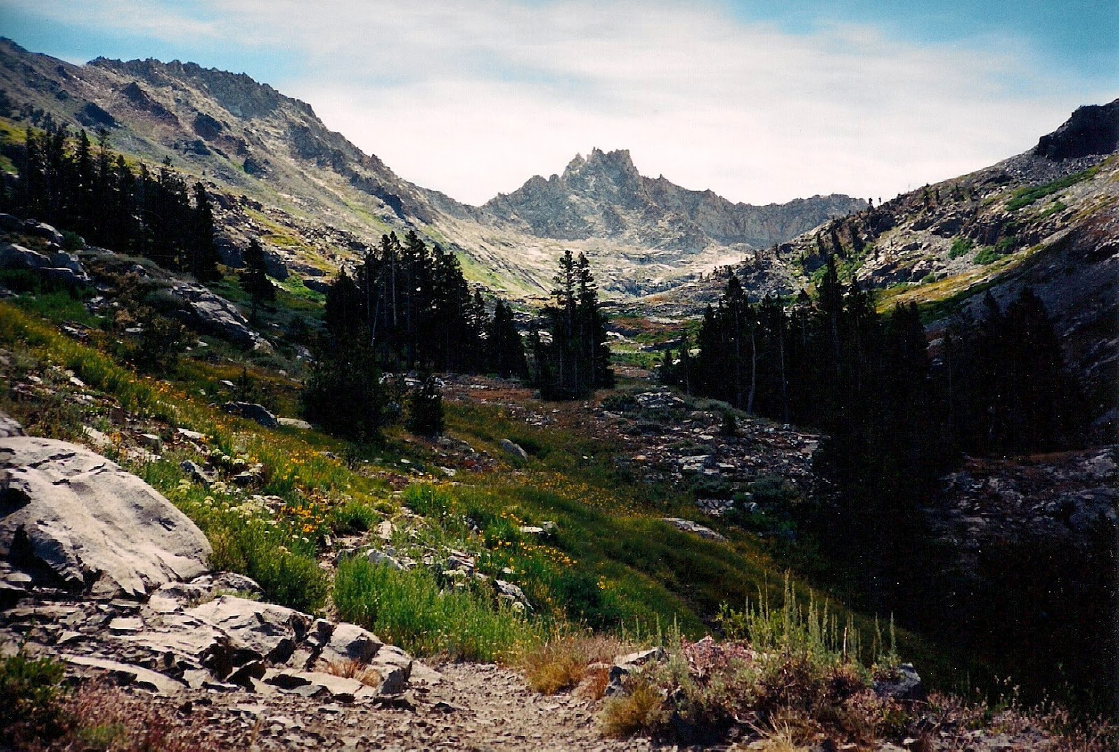
Sunny trail out of Sawtooth towards Timber Gap
And so, after driving 25 twisting and turning miles on the narrow Mineral King road, we donned our packs and set out from the Mineral King trailhead at 7,800 feet  in Sequoia National Park on a lovely sunny day in August of 1999.   Our first  night's destination would be over beautiful Timber Gap and on towards Pinto Lake.

The first few miles actually turned out to be quite hot, and more than we bargained for.  An uphill  unrelenting climb of 2.2 miles took us from the Sawtooth parking area at 7,800 feet, to Timber Gap at 9,400 feet.  That amount of elevation gain is not that much really...unless you are in intense heat.   Ah, the shade of Timber Gap was just perfect for a quick snack and to rest our hot tired feet!  And, as you can see from the picture, just as we reached Timber Gap, the hot sun gave up it's battle to foglike clouds.    Never anywhere else we have hiked have we experienced such swiftly changing elements!  Each trip to Mineral King has astounded us....foglike clouds can roll in and roll out every few minutes with a rapidity that is just amazing!  You just have to have your camera at the ready to capture any of it!
Clouds rolling over Timber Gap

Once on Timber Gap, we began a mostly shallow descent to Cliff Creek Crossing at roughly 7,000 feet.   At one point we walked a very interesting knife edge section of trail with dropoffs on either side of our narrow footpath.   From Timber Gap to Cliff Creek is mostly a treed walk, but don't let that fool you, this is quite an interesting walk.  Once across Cliff Creek,  we began climbing once again in what could be a grueling 4,560 foot climb up to Black Rock Pass at 11,600 feet.   However, we put down roots for the night near tiny little Pinto Lake and spread out our gear under the stars enjoying Mineral King's amazing weather displays.  If you've spent any time on the Coast in the fog....imagine the Coastal Fog rolling right up a hill at you...then 10 minutes later simply disappating and leaving you with a silky black sky overhead blanketed with stars.  Then....ten minutes later watching the fog roll right back in and over the top of you!  Words cannot describe the beauty of this phenomena that I have seen nowhere else like I have in Mineral King.
Near Pinto Lake  on the approach to Black Rock Pass
Hiking thru fields of  lovely "Bigelow's Sneezeweed"

The next morning, refreshed and energized by a sound sleep under the stars, we packed up and headed out once more for unknown territory.  Most backpackers go to great lengths seeking out new trails they've never traveled, and this was one such trip for us.   After a mile or so, we reached Black Rock Pass, and stayed a bit to savor views in all directions.   However,  the trail soon called, so off we went before long and in a short day's hike stopped at Five Lakes Basin for the night.   Five Lakes Basin is home to one of a handful of backcountry ranger huts in the Sequoia Kings Canyon backcountry.   However, the ranger was out on patrol and the hut locked up, so we had the lake we chose all to ourselves for the night.   Perfect!   Solitude is one of the sparkling gems of backcountry travel and we feel quite lucky when we find it!

A thick blanket of clouds had rolled in....
After another idyllic night in the wilderness, we finally were close enough to strike out in the morning for Nine Lakes Basin!  In fact, a little after noon we were strolling up to the first lake in the Basin.    Above treeline though,  I started to get concerned about the weather during lunch.  We huddled down next to a huge boulder for our lunch, and by the time we were done with lunch it was clearly obvious we were going to be chased out of the basin.   A thick wall of clouds had rolled in and drops were starting to fall as the crack of thunder could be heard in the distance.   From the first lake at about 10,400 feet, the basin  is above treeline with the exception of a small grove of Foxtail Pines standing just a few hundred yards east of the first lake.  Foxtail pines are thought to possibly be among the oldest trees in the Sierra, just behind the famous Bristlecone Pines.  Being basically above treeline near these sparse Foxtails, it is most definately not where one wants to be when hearing the crack of thunder rolling in.   So, we grudgingly packed up lunch and headed back down the Big Arroyo Canyon to find a thicker grove of sheltering trees to sit out the storm.

A break in the storm allowed for a quick shot of camp
Interestingly enough, we hiked in and out of sun on the way back down.  And, we had enough time to set up a hasty camp once we found a cozy spot in the trees to feel safe waiting out the storm.    As it turned out though, this would be camp for the night, and we would not be headed back up to Nine Lakes that day.  The storm raged for hours!  Luckily, Gary and I had each brought books and we whiled away the hours absorbed in our books....in between gasping over the cracks of thunder coming closer!    After spending these long hours in our bivy sacks, this trip might have been the beginning of the end of our bivy camping however.  Bivy sacks are like waterproof envelopes that you slide over your sleeping bags.   And a good bivy will have a hoop overhead to keep the fabric off your face.  You stay nice and dry....but there is only room for one person in each bivy so talking to your partner is muffled by each of your little "mini tents."  We have long since gone back to tents and are much happier.

Eventually, the storm passed and we were able to open our bivies and enjoy the night sky at least.  In the morning we packed up and wandered back up canyon again to Nine Lakes Basin.   With an eye on the distant clouds,  we decided not to take the morning sun for granted, and we packed our little lightweight silnylon daypack, stashed our packs behind some rocks and scurried up into the Basin.   Oh what a lovely spot we found!  Each lake a gem, each section of Basin between the lakes a wonder to explore in and of itself.  We could indeed have spent days enjoying this amazing spot.   We moseyed from lake to lake oohing and ahing over the deep turquoise blue of the largest lakes just as I had envisioned, and delighted in the easy travel up the canyon that we had all to ourselves.   Once again though,  the weather would chase us out.  Clouds moved rapidly in,  and as we decided to head back to our packs we heard the first clap of thunder in the distance.  Making a hasty retreat once again, we vowed to come back and spend more time here...it would not be this trip however.
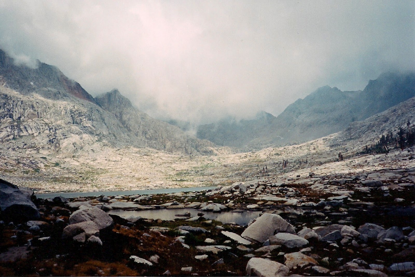
Clouds rolling in over Nine Lake Basin
Taking a last look back  at enshrouded Nine Lakes Basin 
Taking a last look back up at Nine Lakes Basin afforded us no views as the clouds had socked in the Basin solidly.  Knowing this was goodbye for this trip, we headed yet one more time back down canyon towards the safety of the trees.   It being clearly obvious to us that we were destined to put further exploration of Nine Lakes Basin off to another trip,  we pushed off rapidly down canyon not even bothering to try and stay close to the Basin as we had the day before.   Again, once we got a little lower, we had some intermittent sun, but eventually we got caught in the storm with dark wet clouds sending a clear message that we better find a place to berth and batten down the hatches for the night!   Not wanting to be in sparse tree cover, we headed off trail into the forest to the right of us...to the left was a raging creek crossing and sloping terrain that would present no good safe camp spots.   As the rain started falling I got a little frantic and started looking for any spot flat enough to throw down our tarp and bivies.   We had played long enough in Nine Lakes Basin that the daylight was fast leaving us as well, and so without looking around much at our surroundings, but simply spotting a flat spot to sleep on, we unfurled our tarp and quickly set up camp and dove into our bags.   It was late enough, that at least this night we would not spend too many extra hours in our bivies.   But, all night the storm did rage, thunder clapped, lightning thrust fiery arms here and there in the wilderness around us.

Taking pics here and there...
Come morning though...the sun was once again shining  and everything was fresh and crisp and clear.   We lazed around a bit, letting the warm morning sun dry our gear.  Gary did indeed get a chance to read a bit, and  I got to take  my camera and enjoy a chance to take portraits of the freshly watered flowers dotting the forest floor.   As I wandered, I took pics here and there and really focused on my macro or close up shots.  Thus, I wasn't particularly looking at my general surroundings as I crept from flower to flower.  Suddenly though my eyes roved over something I just couldn't make sense of.   A pile of rocks in the loose duff of the forest floor.  But not just a big pile of rocks.,...a flat pile of rocks....no, not a flat pile of rocks... but a layer of rocks.  I stopped looking for flowers and let my camera filled hand drop to my side.  As I cocked my head sideways trying to figure out just what I was looking at,  I gasped,  and yelled for Gary to come look!   He came and puzzled much as I had....cocking his head and looking quizzically for a few moments before exclaiming .... A GRAVE!"
The Grave
My photo does not do justice to what we found that day in the Big Arroyo Canyon of Mineral King.  The rocks were exactly a rectangle about six feet by four feet.  They had been brought from the creek bed  a few hundred yards away and purposely placed here to lie through the ages far from their birthing place.  The soil that held this bed of rocks had sunk about 8 inches so it almost appeared to look like someone had dug a shallow resting spot for the rocks and then placed them in the rectangular hole dug for them.  However, on closer inspection...it was clearly obvious, they had once been piled on top of the fertile forest floor and gradually little by little, and year by year,  had sunk to their current level...that of being almost level with the forest floor.   There was no mistaking what we were looking at.   A very long time ago, someone had buried a friend or loved one, or maybe just an acquaintance, or maybe an enemy here!  And through the years, the body had decomposed, lowering the rocks bit by bit until they no longer rested on top of the land, but nestled down into the surrounding soil.  I would later talk to a friend who had been a backcountry ranger of Sequoia-Kings Canyon for several seasons.  She told me the story of two sheepherders who used to live in the nearby Big Arroyo of Mineral King.  One died of an illness and the other had buried him in a known grave near their cabin.   Noone really knew what happened to the shepherd left behind that had buried the first...and neither do we really,  but I am guessing I know exactly where he was buried.  By whom he was buried, and what befell him will probably always be a mystery however.
Dee just plain having fun!

The rest of our trip was anticlimatic.  No raging storms,  no sleeping near old graves.   However, we explored closely this incredible area on our hike out.   Hiking past the old cabin in the Big Arroyo,  we followed the river down and eventually turned West and hiked up beautiful Lost Canyon.   Climbing up to lonely and austere Columbine Lake we spent another lovely night in the wilderness before going over Sawtooth Pass.  The trail over Sawtooth Pass is an unmaintained unofficial trail, thus not well engineered, nor is it marked.   The trail over the pass is however, fairly easy to follow as it is well used.   Once over the top though, the fun really begins.  The sandy west side of the pass leading back to the trailhead gets quite deep and steep.  At one point Gary and I were running and pushing off into giant leaps downward, feeling much like we were on the low gravity of the moon!  Each step was a  huge springing step down the hill.  Yes, I did catapult myself into a huge slide at one point...landing ignominiously on my bum!  However, it was just too much fun and I sprang back up and took some more giant leaps!  Sawtooth's deep sand provides  great cushion for falls.   And for the first time on our entire trip on this last day, we finally saw other hikers.   As we careened past them on our downhill slolam course,  Gary and I remarked quietly how lucky we were to be going downhill in that deep sand and not trying to slog up through it.   We have since been back to Sawtooth Pass....but never uphill on the sandy west side!

We have returned to Mineral King many times to hike over the years.  A close friend first told me about this area and that it was her favorite.  It has steadily risen in rank each trip to become one of mine.  Go explore Mineral King and find the most fascinating weather in the Sierra,  wonderful wildflowers, perhaps a grave or two....and maybe it will become one of your favorites too.

Hard to get lost in the Sierra Nevada with landmarks like Sawtooth Peak guiding you...

Looking up towards Columbine Basin
Gary playing in Columbine Lake
We always manage to find the most amazing flat spots...
View from Sawtooth Pass "trail." Notice on the top left, the dark brown smooth sloping but flat mountain. The smooth surface is typical of the older non glaciated sections of the High Sierra peaks.  At one time in distant geological history,  before ice and weather etched the peaks, the Sierra was formed of rolling hills. The one you see in the top left being a piece of what was once one of the rolling hills representative of the original Sierra peaks.


Dee on Sawtooth Pass, Mineral King, Sequoia
Dee on the top of the steep Sawtooth Descent...still on fairly hardpack sand...


Gary negotiating the steep westside of Sawtooth Pass 


Dominating Sawtooth Peak from the Westside


End of the Trail.

My Photos

Almost here....my next story.  Someone asked me today if the pictures I post are from the trips I talk about, or borrowed from another trip, or taken from somewhere else.   So, the answer is yes, the pictures you see in each story belong to that story!  I have loved to take pictures as long as I can remember and while so many are in paper form and not digital,  they simply need to be scanned and voile!  So,  shortly you will see a new story upon these pages...photos are already scanned and being inserted....and from that trip!

Wednesday, April 4, 2012

Injured in the Backcountry, or "The Curse of McGee!"

John Muir Wilderness Backpack 
Just under 50 mile moderate 5 day backpack with an approximately 2 mile section of off trail travel. 

"OW! #@*&a;!!!!!"
Upon hearing his oath, I spun and quickly surveyed Gary to see what injury he had incurred.   Asking him if he was okay, and quickly assessing him head to toe, I was instantly relieved not to see blood spurting out, or bones sticking up anywhere.   Gary had slipped down a steep little section of creek bank on slick wet granite while filling his water bottles, but seemed perfectly fine. I complacently turned back to what I was doing ... I wouldn't be so complacent later.

Ever wonder if you got "way out there" and got hurt, what you would do?   How resourceful would you be?   How would you get out of there?   Well, we got to find out one backpack trip in Aug of 2005.   Off trail in the John Muir Wilderness of California, Gary tore the meniscus on the inside of his left knee.   For those who have been unlucky enough to do this, it can be an excruciating and incapacitating injury.

A meniscus tear is a common knee injury.   The meniscus is a rubbery, C-shaped disc that cushions your knee.   Each knee has two menisci (plural of meniscus) one at the outer edge of the knee and one at the inner edge.   The menisci keep your knee steady by balancing your weight across the knee.   A torn meniscus can prevent your knee from working right.   And a meniscus injury is definately not one you want to have happen in the backcountry of the High Sierra, miles from your car and civilization.

Most trips for us are begun on the west side of the Sierra.  Not for any other reason than that the drive to a trailhead is much shorter for us since we live west of the Sierra.    However, simply because we usually do start on the westside, this trip we decided to take a much longer jaunt in the car over to the eastside so that we could journey up trailheads we had never explored.    After studying my maps exhaustively, I presented three potential trips to Gary to look over and decide upon.   And he picked the one that was my first choice as well.   We were all set.   By the night before we left,  maps were made on my computer with our trip highlighted in yellow.   We packed all our food, repackaging everything in baggies so as to fit more supplies in less space per usual.   Checklists were checked and double checked because if you suddenly remember twenty miles down the trail that you forgot something like TP or your toothbrush, there is no running over to your local 7-11.  You just do without!

And, we had a dusy of a trip planned!  The first day would be on trail, then the next day in the area of Big McGee Lake, we would detour around the lake and make our way up a cliff face that would potentially have a very old use trail to help us navigate...and if not, then map and compass would be our guides.  Once on top of the cliff, we planned on camping for the night, then heading down into Hopkins Lake Basin...a lovely spot in the Sierra we had seen a few pics of and gazed at on the map countless times but had never been to.   From Hopkins Lake Basin, we had a very high mileage trip planned that would take us on and off the John Muir Trail as we explored various basins and lakes traveling in a big giant loop North and then East back to our car.   All told, our trip would be close to 100 miles.   Best laid plans...

We actually were able to leave town the night before after packing.  And we got as far as the middle of crossing the Sierra Nevada Mountains before making a late hasty car camp.  Early in the morning we had our last civilized breakfast, donned our packs in the trailhead parking lot and taking one last look in the car to make sure we left absolutely nothing in the car that had any scent to attract bears, we locked up and headed up the trail.

We shared the trailhead with a pack station called McGee Creek Pack Station,  thus we followed a well made and marked trail for the first part of the morning.  Many backpackers bemoan having to share the trails with horsepackers as horses turn the dirt to fine dust that coats everything as you hike, but,  horse packers also spare nothing in clearing trails leaving beautifully maintained clear trails to hike on.  So, we enjoyed an easily navigated trail all the way to our first lake, Steelhead lake.   Here we doffed our packs and set up camp for the evening on a tiny little bluff above the lake... far enough to get us the required few hundred feet from the lakeshore...a requirement standard in most parks and national forests made in an effort to leave the fragile lakeshore ecosystem intact and enjoyable for all those who follow...and high enough off the lake to get us a bit of late afternoon sun.  That first night was not the most spectacular campsite as I prefer wide open views, but, we had the place to ourselves which created quite an idyllic spot to unwind.  First night camps are often not the best, as it can take a day or so to reach the true high country, but anytime out in the backcountry by yourselves is always quite special!

In the morning sun, we dried our gear which is usually a little wet from dew, and headed on up the trail again.   I don't remember this piece of trail having a whole lot of uphill...but there must have been some as I remember being very grateful for a nice granite bench midmorning to drop my pack on and slowly sink down for a rest!   Before long though we had reached our jumping off spot ...Big McGee Lake.  We wound our way slowly around the north shore, stopping frequently to try and guess where we'd be climbing up the wall on the opposite side.
Somewhere on the left wall, we'd be climbing over...
It often seems so impossible, that there is actually a way to get up to the top when you are looking at what appears to be quite vertical cliffs.  Somehow though, as you get closer, the cliffs soften and start appearing less steep, and eventually your route presents itself as quite doable.  We were however in suspense quite some time as we  had to get around Big McGee and then another smaller tiny little lake just up canyon from Big McGee before we could find our path.
Big McGee Lake
 Eventually though, we were around the water and bending our necks back staring up at the top of the cliffs.  Then, as luck would have it, we actually managed to find a bit of the old use trail to start us off.   So we started climbing.    Old "use trails" are not nearly so nicely engineered as latter day trails that have been dynamited and engineered exquisitely.    No, use trails are just that...used spots in the terrain.
A bit of old use trail on Hopkin's Pass


Signs of another traveler in McGee...

One person...perhaps an early native american...or maybe an animal, explored their way up a cliff or mountain.  Then another person perhaps followed that first person's occasional footprints.  And eventually, there is a bit of a worn path where fragile alpine plants give up the battle, and rocks get kicked out of the way, and dirt packs down by years of being stomped on.   There often is not much tell tale sign of the path except intermittent dirt patches well packed down while often there is a fairly decent albeit narrow dirt trail to show you the way.  The trail we found on this day's journey was somewhere in the middle.  There were obvious worn pieces of path...and then spots where we ran out of trail, like a game trail petering out,  causing us to stop and scratch our heads as we looked high and low to see if we somehow wandered off the trail or if it was still up ahead and we just needed to locate it.  And not being an engineered trail with long switchbacks to save your legs, this trail was steep with narrow short switchbacks necessitating we rest our burning calve and thigh muscles frequently.  All the while, we both kept silent watch on a steep overhead cornice that we were just hoping upon hope would not block our path with an impassable sheer vertical block of ice right at the top!
Hopkin's Pass Cornice, looked more passable the closer we got 
Finally though we got right up to the bottom edge of the cornice and Lo and Behold....a final switchback taking us off to the side of the cornice and over the top of Hopkins Pass!  YEA!  Once on top we dropped our packs to enjoy the fruits of our labors and savor the view and some well deserved snacks!
Dee (top) and Gary (bottom) enjoying the well desrved view!


It was once we headed down off  south side of the saddle we were on that we started following the creek Gary was destined to meet.   Passing Upper Hopkins Lakes, the saddle fed into a wide shallow bowl with Hopkins Creek running roughly down the middle.   Stopping to fill our water bottles, depleted after the climb...is when Gary slipped on the slick granite and tore his knee.  It would only be after we got home to a Dr that we would realize the extent of the damage.   But, the pain and swelling let us know right away that something was amiss, and we used our bandanas to create a makeshift support wrap. Erroneously  figuring a good night's sleep would fix his knee right up, we searched for a camping spot for the night.   Lower Hopkins Lake had been our destination, however, the downhill hike to the lake was out of the question, so we found another idyllic little spot at the edge of the trees and enjoyed our view of the lovely meadows around us.  In the morning, Gary's knee was no better.  Darn!  Now faced with a decision...we tossed around our options. First off, we could turn around and go back the way we came.  Problem was, though we had actually come up a pretty nice use trail, it was a steep climb with a little bit of negotiating. Also...no backpacker likes to backtrack! And...no backpacker likes to jettison a trip.  I would have supported Gary in whatever decision he made though, but he chose to continue.  Like I said, we had no idea his knee was as damaged as it was til much later, or we might have chosen a different option.  We just kept thinking his knee would improve "the next day."   So, we looked at our maps and weighed the trail options.  Our original trail of 100+ miles, partially off trail, was OUT! However, there were shorter versions of our trip available that would keep us now on maintained trails. So, we packed up and headed off down to intersect the Mono Creek Trail...and from there, to hike on out to the John Muir Trail.     As we hiked on, our days were slow now, as Gary was very careful not to twist or turn his knee.  Nights, his knee was propped carefully on his extra clothes.  Every morning his knee was wrapped with bandanas.  And, after breakfast and packing, Gary hobbled down the trail with walking stick in hand to lean on.  Creek crossings were extremely problematic as slick stones present challenges for non handicapped hikers.  But, we managed to make headway.  Once on the John Muir Trail we made better time and hiked steadily north ignoring all side trails.  Bemoaning our inability of doing any off trail exploration or side trips, yet still we were thrilled to be in the High Sierra Backcountry!  We enjoyed Pocket Meadow and a favorite secret campsite just south of Silver Pass
Dee enjoying our secret spot south of Silver Pass
and camping near the John Muir Trail before dropping down towards Tully Hole, a deep grassy seemingly enclosed bowl. We were amazed not to run into any other hikers for days. After oohing and ahing over a huge wasp nest on the trail,
Wasp "Paper" Nest
we continued down the trail and entered Tully Hole. Tully Hole and Horse Heaven pastures evoke images of trappers and native americans spending long ago summer days using the Tully for conditioning their stock.  Letting them graze on the tall sweet grasses as they set their traps,  made arrowheads from obsidian flints and sat around campfires laughing and telling tall tales.   As it turns out, Tully Hole is not the enclosed bowl it first appears to be,  it actually has three trail accesses...the John Muir Trail South and the John Muir Trail north....and the route we took out to the East and McGee pass.  The next section of trail was clearly seldom traveled, and in the next couple of days as we headed East towards McGee pass, we would wonder why not!   A more diversified terrain you won't find in the Sierra.  More solitude you won't find.  And we were priviledged to travel by extremely beautiful lakes, meadows and plateaus on our journey back out of the backcountry.
Climbing out of Tully Hole we climbed from 9,500 feet at Tully Hole to elev to 11,900 feet at McGee Pass, also known as Red Slate Pass.  Along the way, we passed an obvious spot Native Americans had stopped in their travels routinely as there were tons of obsidian chips and a few arrowheads littering the ground.
Should you be lucky enough to find this lovely spot too, please leave the arrowheads for the next lucky hiker to ooh and ah over!

Somewhere before McGee pass Gary's knee was really bothering him.  We spied a lovely little peak with a flat spot on top just big enough for a groundsheet and bags, and incredible views...and a nice little stream below.   After going back and forth on whether we should take advantage, we finally decided to take the rest of the day off here... one of only a handful of days we've ever taken as a layover day.  We just could not march through this lovely spot enjoying it only for the few minutes it took to get from one side to the other.  As it turned out, we made the best decision, for in the morning we entered the lovely, but austere and rocky McGee Pass and canyon area.
The lovely but austere and inhospitable McGee canyon area
 It would be awhile before we had views again like what we had had...except on the pass itself.  Even still, the trail was absolutely stunning the next day as it wound in and out and around the McGee Pass area...but would not have made the most hospitable camping spot. And, Gary really needed the rest for his knee. Pain was his constant companion, and the care it takes to navigate the backcountry while injured had been taking it's toll.


Once over McGee pass, Gary and I enjoyed the wild volcanic colors and the twisting and turning trail and actually made pretty good time. This might have contributed to Gary's downfall later on....

As we were getting closer to the car, perhaps a half mile away, Gary suggested I hurry on to the car and open it up and cool it off so he could get comfortable soon as he got there. I didn't see the warning signs. I had watched him struggling with the pain and trying to keep his knee immobile as much as possible and just figured he was drained. In reality, Gary had something much more serious going on.  But, not realizing this, and knowing we were following a well marked path we had been on a few short days before, I left him to hike out as he asked, and I sped on down the trail to the car.  The car was insufferably hot having been sitting in the hot sun all day.  But by the time Gary arrived, the car was open and windows down and the hatch up so he could take off his pack and sit a bit.  I got excited when I saw him, and told him I had everything ready...but my excitement turned to fear that twisted my guts when I looked at his face.  His glazed eyes and pasty skin made it clearly obvious he was on his last reserves and was not doing well.  With his not very maneuverable knee, Gary had slipped once again in a final creek crossing just short of the parking lot and twisted his knee all over again.   It is a testament to his innate determination that he was able to get back to the car on his own!   I helped him get his pack off and fall back into the back of the car to sit a minute and recover.

 It was then his eyes rolled up in his head and he left me!  The parking lot was empty except for a carful of 3-4 college aged kids,  but I yelled at them to come help me.  By the tone in my voice, they knew to come on the run.  As soon as they got there I started telling them what I needed them to do.   I honestly did not know at this point if Gary was alive or not, but as terror stricken as I was, my years of telling others what to do in medical emergencies took over and I gave them exact directions.  We got Gary out of the car and laying flat on the pavement.  I prevented them from putting clothes or anything else under his head and explained that I worked at 911 and needed him flat with his head tilted back, and then I started checking for breathe.  It was then that I saw it....a little flutter of an eyelid.  At this point,  I just did not care what those kids were thinking or how personal a moment this was for us when I was telling Gary to stay with me!   Finally,  he opened his eyes and looked at me and I knew I had him back.

I don't know who those kids were, but without their help, I don't know what would have happened as Gary was in a pretty dire straits and needed  his airway opened up by tilting his head  back, so I will always be grateful for their help!   They waited a few minutes to make sure all was okay with us and we thanked them profusely, and they went on their way.  By this time, Gary had managed to get in the passenger seat of the car and we started driving down out of the mountains.   We discussed seeking immediate medical help,  but Gary said he really just needed food.  So we stopped at a favorite stopping place of our's,  "Whoa Nellie's Deli," and had steak salads before heading on home.  As it turns out, we should have seeked medical attention, for we later found that Gary had had a blood clot from his injury that had caused the later problems!  When we got home, the Doctor Gary saw immediately put him on blood thinners for 3 months and diagnosed the meniscus tear.    In hindsight, though we thought we were being conservative in our actions...we had risked all to complete our trip.  We ended up making a 9 day trip into 5 and cut 100 miles of on and off trail travel down to 50 miles of all on trail travel.  But, if we had it to do over again, we would be even more conservative and most certainly hike out the fastest route we could possibly find and abort the trip in seeking medical attention....maybe....:)

Don't let our experience in McGee scare you off...the  phenomenal beauty of this area justifies visiting!

Saturday, March 24, 2012

First Rate Books To Read!

If you like my hiking stories, then here are some true story adventure books I've read and was thoroughly entertained by that you might also enjoy! ..................................................................................................................... 1-The High Adventure of Eric Rybak, or The Ultimate Journey,  Canada to Mexico by Eric Rybak. These stories were written by a young man who hiked the PCT (2,650 mile Pacific Crest Trail) by himself at age 18.  Then hiked the CDT (3,100 mile Continental Divide Trail) a couple of years later with his brother accompanying him part way.  And, he was the first to hike the "Triple Crown." The CDT (3,100 mile Continental Divide Trail), the PCT and the ADT (2,100 mile Appalachian Trail). These books are out of print, but I actually found one of his books on Amazon...his story of hiking the CDT!


.....................................................................................................................


2-Zero Days. Here's a true story of a family who hiked from Mexico to Canada along the Pacific Crest Trail! They manage to tell the story from all 3 viewpoints, Mom, Dad and 10 yr old daughter...and they pull it off delightfully well! Loved this book! .....................................................................................................................


3-Hiking the Continental Divide Trail. Another great read! This gal starts out hiking the 3,100 mile Continental Divide Trail with her husband. The CDT is a trail from Mexico to Canada along the Continental Divide that is only partially complete and therefore is considered the toughest of the long trails in the US. Her husband has to drop out midway due to foot problems and the author decides to finish her backpack journey alone! The CDT (Continental Divide Trail) is not clearly marked, very remote and very long....my hat is off to her...her amazing determination makes for a great story for us to enjoy! ..................................................................................................................... 4-Skywalker. Skywalker can tell a tale! Following Skywalker as he walks from Mexico to Canada is very entertaining and you won't be able to put his book down til the end!:) ..................................................................................................................... 5-Dances With Marmots. This author takes a leave of absence from the fire service in New Zealand to hike the Pacific Crest Trail...despite never having hiked before! He pulls it off...and shares his journey with us in an engaging and humorous and entertaining way! Must read! .................................................................................................................... 6-The Trail Home by Alfred Wohlpart. Alfred Wohlpart obviously wrote a journal as he traveled the PCT. But this is no “dry, dull, diary.” Wohlpart’s story is entertaining and engaging and written in present tense so that you get to take the walk with him as he hikes. Another great read…enjoy this one!:)

Friday, February 17, 2012

Lost in the Snow

Yosemite National Park backpack
An approximately 28 mile semi loop 3-4 day moderate backpack,  including a short,  roughly two mile section,  of off trail travel for those who want to get their feet wet at traveling by map and compass!


Off trail for the initiated is pretty much the only way to hike.   The solitude, the peace, the chance to see wildlife grows exponentially when you get off the beaten path.  And,  off trail is pretty much the only way my husband and I hike anymore.  You will find stories in these pages more and more about off trail hiking if you stick around long enough.  A few hours up a known and marked trail....then we hop off the path for adventures unknown and hike by map and compass only.  We haven't gotten a GPS yet,  and after this experience I am about to share,  we learned it is best to be knowledgeable enough to navigate without GPS even if you are going to carry one.

The Sierra (notice I did not say "The Sierras" as that is a misnomer as there is only one mountain range, not several,  thus the name is correctly "The Sierra," but I digress...) is the ultimate playground for backpackers.   Folks chomp at the bit all winter long if they don't winter camp and they can't wait for the roads to open and the trails to start peeking through the snow.   In fact many hardier backpackers start their season as soon as the first road opens and head for the high country while snows still blanket the land.   My husband and I are among those hardier backpackers.  We are just impatient enough to head out as soon as we can possibly get anywhere near a trailhead.   In the spring of 2000 on Memorial Day,  our first hike of the Sierra season was to be theoretically a mostly on trail hike with just a couple miles off trail in one little section.  Notice my use of the word theoretically,  as any backpacker knows that if you hike early season,  snows can turn any "on trail" hike into a map and compass "blood,  sweat and tears" extravaganza.   Our trailhead this year was out of Wawona,  heading up to Chilnualna Falls where you better have your camera out and ready as the rainbows down canyon from the falls as you are hiking up canyon are simply stunning.

Chilnualna Falls Rainbows...

For those who don't want a swashbuckling adventure,  but just a nice early season getaway,  Chilnualna Falls are a lovely overnight early season destination.    However,  this trip,  we bypassed the falls and pushed on heading North and slightly West "on trail" towards Turner Meadow,  then East to Ostrander Lake,  going off trail for a short distance to catch the Buena Vista Trail to Buena Vista Lake then Buena Vista Pass to Royal Arches,  Johnson Lake then ultimately back to Chilualna Falls and back to our car.  Nice little loop with lovely country,  views of the breathtaking Clark Range along the way, and mostly "on trail" for an "easy" first season warm up trip.

By the time we had gotten just a short way past the Falls heading to Turner Meadows though,  the snow was starting to get thick on the ground.  We weren't yet postholing,  that would come later.   But, we were already starting to look for patches of trail and cut logs indicating trail under the snow,  and the park's old pathfinder "i" marks carved in the trees.   However,  since we were in the trees we weren't too worried about the snow,  as once we got back out in the open and especially in the sections above treeline,  the sun would have helped us out,  and we'd have plenty of snowfree trail patches peeking through the snowcover to keep us on route.   The morning was a bit of a slog though,  and postholing began in earnest at some point before lunch.  By the time we called a halt to break for lunch,  I was beginning to wonder what this trip had in store for us!

Sitting on a log in the trees enjoying a large juicy orange after our cheese and crackers brought us back to battery though,  and we set off once more.   The snow piled deeper and deeper as we went higher and I was quite grateful for my gaiters.   After spending the better part of the day in the trees and snow, we finally broke thru the trees into the open.    And by this time,  having clawed our way through deeper and deeper snows as we navigated higher and higher, it was no surprise to find the entire untreed landscape was solid white!  Snow covered everything ...so much for the sunbaked areas blessing us with snow free patches of trail!  In fact,  there was enough snow that there were still cross country skiers about!  We joined the handful of skiers milling around Ostrander Hut briefly,  then left them behind as we headed off trail for Hart Lake not too far away.

After about 15 minutes trudging through the snow,  we noticed that two guys we had seen at Ostrander Lake were also headed off in the direction of Hart Lake.  They were roughly 30-40 yards below us traversing the same slope about the same pace,   and we had intermittent views of them and had given each other grins and nods as we all slogged through the melting deep snows of spring.  Gary and I  had actually never been to Hart Lake before.   Generally it's a good idea to hike to a place in summer that you plan on hiking with snow still on the ground...but then we hadn't planned on all this snow!   Oh well,  we learned long ago to be flexible and roll with the punches.   And if it got bad enough,  we could double back the way we came from,  and jettison our trip plans if need be.  So far though,  our spirits were high,   so we kept on hauling ourselves through the snow.  As the daylight starting getting short and the sun started dropping in the sky though,  I chanced to look over at the two guys we had been mirroring and noticed that they were waving us over.  They were studying the terrain ahead and had some concerns about the route to take.  Gary and I pulled out our map and took a look...we were right on target.  We knew we were close to Hart Lake finally,  and it being obvious by now that we were all headed to the same destination,  we decided to go the last bit together.    Probably no less than 30 minutes later in fact we were standing by the shores of the lake admiring it's smooth clear reflections!


Hart Lake With Enough Melted Snow to have a section of the lake showing lovely reflections....

The kids we had been hiking with decided to set up camp by the water.   Gary and I long ago decided we did not like to have lakeshore camps as they tend to be colder and buggier,  so we bid our friends adieu and headed around the shore to climb the little ridge on the north side and catch the last warming rays of the setting sun while we set up camp.   As we began to part ways,  I heard one of the kids say "wasn't it great that we made it as far as Buena Vista Lake already?"   Warning bells went off in my head as I spun to look at Gary,  and caught him glancing nervously at me.  We both thought the same thing...how could we have so misread our map!   We thought we were at Hart Lake...which is a good two miles before Buena Vista Lake!  Wow!  Over all the years of off trail hiking we've made just about every bonehead mistake we can make reading a map.   But...we thought we were finally getting so good at it,  how could we be so off this time.   Suddenly worried about being off trail without knowing exactly where we were,  we hustled around the shore and up the ridgeline and dropped our packs to figure things out.   Gary and I both grabbed at the map and stared at it!   No... there was the ridge depicted by the squashed contour lines on the map.   And... the lake in front of us with it's distinctive shape matched exactly the Hart Lake drawn on the map.  The open plateau we crossed between Ostrander and Hart Lakes was unmistakable too.  It was clearly obvious that we knew where we were,  and that was right at Hart Lake!   I told Gary we needed to go talk to those kids and show them the map.  Gary offered to go talk to them while I stayed and started setting up camp and getting dinner ready while I still had some sun to help me.  Once the sun goes down,  fingers get too cold to be out trying to work zippers on bags and turning knobs on stoves!  So, I began working on camp chores as Gary began picking his way back down the ridgeline.

Gary was gone quite some time,  but by the time I had tarp and bags out and dinner about ready,  Gary finally wandered back up the ridge to our little flat spot we called home for the night.   "Did they believe you?  What did they say?  Are they still thinking they are at Buena Vista Lake?"  The words rushed out of me,  as I stood impatiently waiting to hear what happened,  for it is no simple thing to be lost in the wilderness thinking you are one place and are really at another!   Gary had delicately explained to the kids that it might be a good idea to look at our map.  He pulled it out and showed the boys the ridgeline,  the lake,  the plateau and a few other features displayed on the map that were quite prominent in the landscape around us.   At first they didn't want to believe him.    It meant they had farther to hike tomorrow.  And they pulled out their GPS to get a reading.  It seems you need 3 satellites to triangulate your position and they could only get 2.  Their GPS was useless.  And....they didn't really know how to read a map well having relied on their GPS.   But,  they did end up seeing what Gary and I saw on the map and knew for sure that we were all at Hart Lake!  Thank goodness.   We relaxed then, enjoying our quiet supper and warm cups of cocoa as we sat in our bags watching the stars unfold in the inky black sky.  Finally,  we snuggled down in our bags and nodded off watching shooting stars streak across the night sky above us.

Lazing around our little flat spot on the ridge

With the morning's light we were up and at it and on the trail first,  pausing to say goodbye to our new friends as we left the lake bowl.   They were headed in a completely different direction than we and we would not cross paths again,  or so we thought.   Sauntering off in the warm morning sun,  Gary and I had an "easy" downhill stretch for an hour or so as we dropped down to a creek crossing,  both enjoying the long downhill before our eventual climb back up for our midmorning snack on Buena Vista Pass.  At the bottom of the slope we actually came across about 2 feet of exposed trail! Hallelujah!  We were on the right path!   It is amazing when you are going by map and compass how such a little thing like a sawn log (The only reason for cut logs in the backcountry is for trail clearing) , an "i" blaze on a tree,  or a tiny short section of exposed snow free trail can boost your spirits as you realize you are right where you thought you were!    In fact, it's quite a feeling of empowerment to wander through the wilderness by map and compass and pass from one landmark to another knowing you can go where you want and always find your way home.   And that's exactly how we felt this lovely morning.  We reached the creek and criss crossed right over the top of it...walking on snow laid so thick over the top of the creek that we had no fear of falling through and into the water.   And knowing exactly where we were made the morning that much sweeter.   Too bad that feeling wouldn't last!

Our level path eventually starting climbing,  all good things must end,  and so the climbing began.   I don't remember the particular details of how steep that climb was or how long,  but it was a workout.  In due time though,  we topped through the thinning trees obtaining wonderful views from the top of 9,040 foot Buena Vista Pass.   Spotting a nice exposed dry spot on a large flat car sized boulder,  we clambered up and sat down stretching our legs out to a midmorning snack with some absolutely magnificent views!   Most times we seem to eat fast and move on quickly,  but this day we truly enjoyed our rest.   Finishing,  we packed up and started off to go down the South side of the pass and had gone a couple hundred yards when all of a sudden I realized Gary was waving at someone!  I spun around to see who on earth could possibly have hiked as hard as we had through all that snow and gotten way out in the middle of nowhere as we had.  Due to the distance,  it took me a minute to recognize who it was.   Coming up the last few feet of uphill towards us,  the two figures hollering out hellos and waving vigorously,  were the kids at the lake from the night before!   Puzzled,  we both headed back to where we had stopped for lunch and met them.   "We're Lost,"  they both exclaimed. Gary and I took off our packs once again as obviously we needed to help them,  we weren't just going to leave them stranded out here.  As their story unfolded,  they apparently had packed a short time after us and headed out on their path,  but had quickly gotten hopelessly lost.  So, they managed to backtrack back to where they had last seen us,  and had followed our tracks all morning,  catching us finally all the way up on top of Buena Vista Pass!  And we thought we had worked hard that morning!    Looking at the map,  Gary and I spent some time figuring out a route for them to follow out.  Their car was left at another trailhead in an opposite direction from ours,  so they didn't want to follow us all the way out.  But,  we found a nice ridgeline that slanted down into an obvious valley that should lead them right back to their car.  They thanked us profusely and headed on their way.    That truly was the last we saw of them,  but we thought of them the rest of our trip,  wondering if they had had any more difficulties finding their way,  and wondering if they made it out to their car.  We even checked Yosemite websites after to see if any missing hikers had been reported!  Thankfully,  none had been.

Finally Gary and I were making our way off the pass and into another drainage.  What a beautiful morning!  The sun's warmth kept us company all that morning as we had an easy stroll down a gradually sloping valley.  At one point we were amazed to realize that though we were walking on a thick snow blanket covering the entire valley,  we could hear water quite clearly rushing underneath our feet!  The crusty ice on top was thick enough and hard enough that it kept it's form and the water melted and ran under the crust!   Hiking down a large granite slab,  we had no fear of falling through the icy crust,  as we would just hit solid rock,  but it was quite interesting to realize we were literally walking on water!

After a couple hours of moving down valley though,  things started not adding up.   We kept expecting to find a little lake.  Also, we kept expecting to see the Royal Arches,  a landmark that should be carved in the cliff faces to the left of us by rockfalls.  But, neither of these landmarks showed,  and the landscape just kept looking the same...snow and trees.   In fact, all we saw were trees,  trees and more trees on the sides of us with the neverending steady roar of rushing water under the snow below our feet.  When you are offtrail and not finding what you expect to find,  after awhile you start getting irritated and concerned.  We inspected the map repeatedly,  but it didn't change a thing.   I wore my compass on a string around my neck and checked it, and rechecked it to no avail.  Finally Gary called a halt.  Suggesting we stop for lunch and get fuel on board while we scrutinized the map more thoroughly,  we pulled over and dropped out packs and both slumped down on a pair of downed trees facing each other.  After a few minutes we called on our mental and physical reserves and started putting together some lunch.  We pulled out our humus and pita bread which helped immensely,  the map study did not.   I told Gary though,  that I bet within 20 minutes of restarting,  we would find the arches and lake.   Our spirits recovered somewhat due to the fortifying lunch, and we resolved to stay upbeat and find our lake.


I wore a compass around my neck and checked the map repeatedly

Standing once again,  we pushed off to find our route.  The landscape began flattening out a bit and the tree cover thickened.  I told Gary I wanted to aim left a little bit and check out what was on the other side of the trees as it looked like they were thinning to the left of us.  About five minutes had passed after leaving our lunch stop and as we shot left through the trees,  all of a sudden I saw a tiny patch of turquoise about a foot in diameter at my feet....staring at it a minute,  I suddenly realized we were standing at the edge of the lake!!!!  We had found it!  We knew where we were!  Looking up across the snow covered lake we recognized the arches etched in the cliff face!  They waited patiently through the ages for just that moment of us finding them!  If you've ever been lost,   and then found your way,  you know how excited we got! There really was no lake to find,  as it was covered in snow,  thus we never would have been able to see it through the trees.   Only in varying our route slightly and edging closer to the cliffs were we able to spy the one tiny corner of the lake that had turqoise ice showing instead of snow.  Talking a mile a minute,  we reveled in the beauty around us, enjoying the exhilaration of finding our way!


Royal Arches on the far side of the snow covered lake....

Eventually it was time to push on,  as we had a few miles left to go before setting up camp for the night.  Still with no trail showing though,  we slid through the trees looking for the creek crossing we knew was not too far ahead.  This creek crossing would mark a change in scenery that would lead us down a newer and easier section of route.  We would be tracing a watershed downhill until eventually we'd come out of the backcountry to Chilnualna Creek near where we began our journey a couple of days ago.   I don't recall it being more than 30 minutes later when we found something we absolutely did not expect to see...we came across a trail sign!  An honest to goodness trail sign peaking thru the snow right in front of us!  Snow was still our constant companion,  and this was the first real sign of trail we had seen since what felt like days ago,  but was really only hours ago.  The last sign of trail we had found being that tiny patch of snow free trail by the creek below Buena Vista pass.  Yahoo!  A real trail sign!


Kissing the trail sign!:)


Spirits up,  we continued down slope and shortly thereafter we started dropping elevation quickly and could hear the water roaring louder and louder. Uh oh...we could hear the water "roaring."  This was supposed to be an intermittent seasonal creek, a dotted blue line on the map,  a creek that in some seasons was completely dried up.   Getting closer to the roaring water whose noise drowned out all other wilderness noises,  we were chagrined to see our seasonal intermittent creek was a frothing,  leaping,  foaming white water river!   And,  to top it off, this roaring,  frothing unexpected river blocked our way,  and we absolutely had to cross it to get where we needed to go.   The only other option being to turn around and backtrack,  retracing our entire trip...but we were two thirds done with our trip!  We had hiked almost two full days in some not so easy hiking conditions,  and all we had left was a bit more today and then a long next day and we'd be back to the trailhead.   Determined to cross,  we spent quite some time trying to find a way.   We did find one tiny snow bridge left that really wasn't an option for me.  The "creek" was about eight feet across and several feet deep.  A fall into the water would be quite ugly.  The day was late and the water swift and a dunking could mean being flushed downstream uncontrollably,  or at the very least suffering life threatening hypothermia.  So, we went about a half mile upstream....then a half mile downstream.  We found not one fallen tree to cross over on,  we found not one spot where the creek widened enough to allow the water to get shallow enough to wade through.  We were getting desperate!   Light was fading fast and we just had to find some way to cross!  Finally, Gary decided he wanted to cross at the little snowbridge we spied when we first came out to the "creek."  So,  we went back once again to look at it.   It is true the snow bridge was fairly wide where it attached to the banks, maybe even five feet wide,  but in the middle the bridge narrowed to about a 12 inch waist!  I was just plain scared.  Broad jump was one of my events in school long ago, but my life never depended on how well I jumped back then!  After debating several minutes,   Gary asked me,  if he crossed it first successfully,  would I try.  I grudgingly consented.  What was I thinking?!  So,  giving himself some room,  Gary backed up and took a running leap.   He flew through the air landing on the far side of the snowbridge.  But,  he missed landing solidly on the bank by about a foot.  With one foot on the bank, he was not in danger of falling in,  but as he landed,  the foot dragging behind jammed harshly onto the snow bridge.  The concussion of his weight and his leg punching down on it left a gaping crack running the entire width where the snow bridge attached to the bank.  Gary was now on one side,  and I on the other.  And we both stared at the damaged snowbridge with it's obvious break running along the bank's edge where it once attached solidly to the bank and realized it would break completely free at any moment and be swept downstream. Gary was yelling something at me,  but I could not hear him over the roar of the water.   Gesturing wildly,  he was telling me to go ahead and jump!   No way!   I couldn't do it!   I'd fall in!   I'd die!   He then mimed at me to throw my pack over first,  that I could do the jump if I had no pack.  Maybe he could pull that off,  but even if the broadjump was among my best event in school, the softball toss and shot put were my worst events.  I'd throw my pack right in the water if I tried that!   I went up stream and down yet again looking desperately for any way at all to cross.   But,  I found absolutely no other way across.  I suddenly realized I had no choice other than to jump,  and the longer I stood debating and looking and hoping,   the more scared I was going to be.    I backed up several feet and without thinking another thought,  I ran as fast as I could and jumped! Disaster!  I landed sprawled on the broken snow bridge that at any moment was going to break free completely and be swept downstream with me on it!  With my feet dangling dangerously in the water, not able to get any purchase on the snowcovered bank,  it would be only moments before I was swept away if I couldn't get onto the bank.  Suddenly,  Gary reached down and I felt his solid hands under my armpits as he yanked me up,  pack and all,  right out of the water and off the snowbridge and onto the far bank!  Shocked,  I lay in the snow shaking with the aftermath of fear and adrenaline coursing through my veins.  I dared not try to stand.  When finally I did manage to gain my feet,  my legs were pure jelly and I could barely take a step.   I'd never experienced that depth of fear and adrenaline before, and have not since.  Finally though,  I recovered enough to walk and we pushed off slowly,  moving faster as my strength returned,  looking to find a place to set up camp and get me dried off before complete darkness overtook us and hypothermia set in.

It never ceases to amaze me how cozy and homey the backcountry becomes once groundsheet is laid, bags are fluffed out and warm clothes donned.   All the travails of the day slide away and aches and pains go from a dull roar to a simmer taking a backseat to yummy warm food being prepared and eaten, as the dark curtain of night drops down over the surrounding landscape and stars start making an appearance on nature's overhead stage.

The rest of the trip was anticlimactic except for a couple of small events.  As we made our way downstream,  the snow cover got thinner and easier to slog through and by midafternoon we came out of the wilderness and towards a guy and a girl sitting on the banks of Chilnualna creek soaking up the sun.  As we approached,  we gave them a jolt, a s we were the last thing they expected to see.  The guy looked at us briefly before blurting out  "You came out of there?!"  with total amazement.   We just smiled and said that yea,  there was a bit of snow back there as we continued quietly past them.  Ah,  we had found other backpackers... we made it.   But...we were a bit premature in our congratulations to ourselves as suddenly we noticed that the one last creek we had yet to ford seemed about 50 feet wide and about 3 feet deep and MOVING!  And,  we also realized that this same "creek" was the lovely Chilnualna Falls with five tiers of falls,  the first fall being about a hundred foot drop!  And we weren't sure exactly how far away the falls were,  but we were guessing not more than a few hundred feet downstream!  Not again!   But,  continuing a few minutes downstream,  thankfully we came to a downed tree across the creek.  Thank goodness!  Thinking what a piece of cake this was going to be,  I hopped up on the tree first and started to cross.   I didn't get too far though before I realized the water was deep and swift below me and this log had been used as a crossing for a very long time as it was slick and smooth and hard to get a grip on with my shoes.   In addition,  there were a couple of branches sticking up on the way across that made it even more difficult to cross due to having to twist and turn to try to slide my pack through the branches.  Finally I gave up and started backtracking pushing Gary back to the shore we had just left.  Deciding he would give it a try then,  Gary hopped up and after a couple of minutes,  was safely across.  Then,  he turned to wave me across.  But,  the more vigorously he waved at me to cross,  the more vigorously I shook my head no.  I knew I could not do it, at least not with my pack on.  He tried yelling helpful instructions to me but it was no use,  the roar of the "creek" drowned out all voice.  Finally, leaving his pack on the far bank,  Gary came back across the slick downed tree to me.  He gently took my pack from my shoulders,  put it on his back and made a second trip across the log.  Taking a deep sigh of relief,  I hopped up behind him and slid across the tree ...on my fanny!  There are times in a marriage when you are so grateful for your partner,  and I will never forget the help mine afforded me that one spring in Yosemite hiking in the snowy backcountry above Chinlualna Falls!

Try this loop sometime for a bit of offtrail exploration and solitude.  While the rest of the hordes of Yosemite backpackers head for the true high country of the Clark and Cathedral Ranges east of this area,  with the exception of the Chilhualna Falls and Ostrander Lake,  this area remains lightly traveled for most of it's route.  Experienced offtrail backpackers will enjoy this trip very early season,  "creek" crossings and all...and for the rest,  I would suggest waiting til mid June at least!

The John Muir Trail - part 7

  The John Muir Trail part 7…long hot dry stretch!   There was very little of the JMT we had not hiked before in other journeys.  We had cri...